What a wonderful world, yes what a wonderful world we live in. I can’t tell you the number of wonderful people we have met as we have been travelling. From Minneapolis to Australia, from Ohio to Quebec, from Florida to Germany, just wonderful people with stories to share. We might camp next to a couple from Australia one night and move on the next day and when we pull into a park here they come. We might take a doggy walk with Lily around the park and stop to visit with a couple from Quebec and pretty soon an hour or two have passed and then we might see them again down the road a few hundred miles at a different park. It is a wonderful world and we are lucky to be part of it. We also gather information from people who have been to Alaska. This is a great resource for any one that travels. Len from Eau Claire, WI is a great example. We camped next to Len, who is 77, his friend, who is 74 and Len’s grandson. Len is on his 9th trip to Alaska and shared so many stories and wonderful places for us to visit. He was an amazing man and loved to talk. We look forward to these encounters.
 A little on Canada highways and I’m sure it will be the
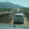
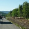 same with Alaska with the thermo heaves and pot holes. You might be driving down the highway at the posted speed limit when you see the squiggly road sign. You better pay attention to those signs because if you don’t slow down you are in for a ride. Sometimes there might be a small red flag to mark “the spot” but sometimes they might just sneak up on you. You better keep your eye on the road. So far we only had dishes flying out of the cabinets in the back once. Broke a
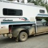
  few dishes and spilled a gallon of water on the floor but we thought it could have been worse. And then there is the road repairs – miles of black top dug out and you drive on gravel. Sometimes they water the gravel down (which then cakes on your vehicle) and sometimes you just travel in dust (which attaches to your vehicle). Either way it is very slow going and you come out with an extremely dirty vehicle. Most RV parks have RV washes in them. So for a fee you can wash the grim off. We decided to wait until we got to Alaska to wash ours since we knew we were going to travel on gravel by going on “The Top of the World Highway”.
 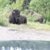 After we left the national parks the drive has
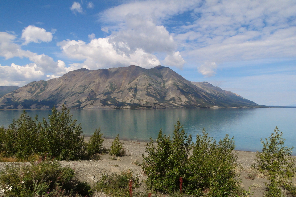
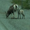
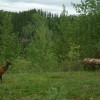
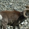
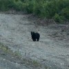
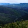
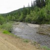
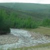
 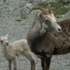 been a little monotonous until the road between Fort Nelson, BC and Watson Lake, Yukon. The road was very hilly and windy with several waterfalls we stopped at. But the best thing was we saw several Wood Buffalo and Dall sheep. We even caught some baby sheep crossing the highway with the moms.
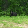
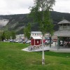
 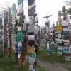 At Watson Lake we stayed in a campground in town so we could walk to the Forest of Signs. In 1942, a simple sign post pointing out the distances to various points along the tote road being built was damaged. Private Carl K. Lindley, serving with the 341st Engineers was ordered to repair the sign, and decided to personalize the job by adding a sign pointing towards his home town, Danville, IL and giving the distance to it. People started adding directions to their home towns, and the idea has been snowballing ever since. Today there are over 77,000 signs posted. It was interesting but Joe and I got a little scare while touring the forest. A group of Native American men were drinking in the center of the forest and when we came upon them they made some not very nice comments about the tourists. We quickly left the area. It is not very often we get that feeling we are not in a safe spot and this was one of those times. The next day we had a similar incident as we were leaving Watson Lake. We had a little issue with the mini and we made the mistake of moving away from the campground to fix it instead of fixing at the campsite. The mini had shifted a little to one side on the truck (because of the roads) and Joe felt it need to be adjusted. But not using our heads we drove down the highway a little ways and pulled over on a dirt pull out. First I have to say that the shift took us an hour and a half to adjust back to where it should be but while we were working on it two men with backpacks came walking out of the woods. Joe and I were a little nervous but they walked passed us to the highway where they caught a ride. We told each other that this was a lesson learned. If we have something that goes wrong we need to be in a safe place if possible to fix it. We were lucky this time. The plus to this story was that while we were working on the mini a momma dog came out of the woods looking half starved. I gave her some treats we had in the truck but after looking at those sad eyes got her a big bowl of dog food soaked with milk. It took her just a minute to chow it down and then go back off into the woods. We figured she must have had her babies tucked away close by.
 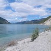 After leaving Watson Lake we just drove down that good old Alaskan Highway. Stopped at two different Provincial Parks overnight that were beautiful and made two stops (on two different days) for the world’s best cinnamon bun and the world’s largest cinnamon bun. The first stop at Johnson’s Crossing we had a bowl of homemade beef barley soup and a homemade bun which were both excellent. We bought one of their World’s Best Cinnamon Rolls for later. Everything was excellent. The next day we came across Braeburn Lodge which advertised the World’s Largest Cinnamon Bun so of course we had to stop. We cut it into four pieces which one piece was still too much to eat at one time. It was large but really not the best. No more cinnamon buns or Joe and I won’t be able to get in our back door.
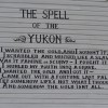
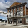
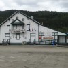
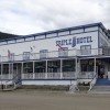
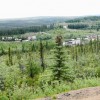
 Our last stop before we went on The Top of the World Highway and entered Alaska was Dawson City. We were able to camp in the center of town and enjoyed walking around and having lunch at Sourdough Joe’s. My first Alaskan halibut and it was yummy. Dawson City is an old mining town that now is trying to make a comeback with the tourist business. It was so much fun walking on the old boardwalks through town and going into shops where the floors are very unleveled. Cute town. Picture below “The Spell of Yukon” was painted on wall outside of building
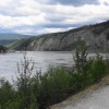
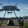
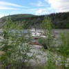
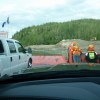
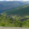
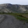
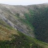
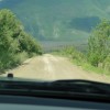
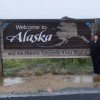 From Dawson City we caught the free ferry to cross the Yukon River and start our journey on The Top of the World Highway. This highway goes from Dawson City, Yukon Canada to Tok Alaska. It is a 175 mile adventure with no services until you get to Chicken at 108 miles. About 65 miles in we crossed the border into Alaska. As we have travel led we’ve read and heard stories about the highway. Most say don’t take a big rig (which we saw many of) and take your time. A suggested time is six and a half hours. It took us seven and a half with stopping for lunch in Chicken. The road runs along the top of the tree lines at about 4500 feet. It is really beautiful with the mountains and valleys. We decided to catch the ferry at 7:00a.m. so there would be little traffic on the road especially before 9 since the border didn’t open until that time. We wouldn’t meet any oncoming traffic for hours. That worked great! About two hours into our drive heavy fog set in and we decided to stop along the road for a bowl of cereal. Nice to have the generator with – Joe started that and we had coffee and tea in our Keurig with a great view. The fog got a little better and we crossed the U.S. border around 11:00. From there until we got to Chicken, Alaska, about 40 miles was one of the worst roads we have ever been on. The first 10 miles or so after the border crossing was freshly paved and a tease. We hit the dirt about 12 miles out and it went downhill from there. We drove between 15 and 20 mph and they warn you about sections of the road where it is too narrow to meet an oncoming car so you should pull over and let the car pass but don’t pull over to far because the shoulder is soft and you could tip over and most places it is a straight drop off. And by this time the northbound traffic was coming so several times Joe pulled over and waiting for a RV or car to pass. Sometimes even when he pulled over the oncoming vehicle wouldn’t pull over far enough and we thought we would hit mirrors. We came across a man standing in the middle of the road after he hit a soft spot and went off the road and was saved only by trees. He said he had an hour or so wait for a tow but someone had stopped and gave him food and water so he was doing fine. The drive was beautiful as well as being intense. We were happy to come to Chicken and stop for lunch.
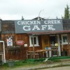
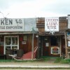
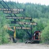 Chicken is another old gold mining town of about 100 people. But they manage to have a couple of RV parks, a few restaurants, a bar, and a mercantile. Oh of course they have the “Chicken Poop” their public outhouses. The town has no electricity or water. They run on a huge generator and have all their water trucked in. Talk about old buildings – oh my! Fun place to stop but we were ready to get to Tok, Alaska and settle in for a few days. We needed to rest up from the drive and catch up on wash both clothes and vehicles a job that is now done. Off we go tomorrow to Fairbanks to get an oil change. Those things still need to be done.
Joe and I are so lucky – again we count our blessings every day. God has blessed us! Stay safe! – Love to our friends and family – love you kids, Cate and Alex! Yea! We have phone service and Verizon again!